My Favorite Picks:
Wallace, H. (2009). World picture atlas. Mankato, Minn.: QEB Pub.
No Lexile found, estimated approximately 770
Complexity Band: 4-5
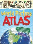 This picture atlas is filled with animals, cities and people of the different regions. It is unique in not only showing a map of the region by actual photos of the cities in the region, but the animals and people that are common in the region. An added touch that might draw students attention is: for each region they give an example of a catch phrase that is popular. This book could be used for second graders with direction from educator. The first few pages explain the layout of the book and how to use it. While reading about the geographic locations there are bolded words. The bolded words can be found in the glossary in the back of the book. This would be a great value to a Social Studies or Geography lesson; students seeing faces of people from other countries will make them easier to connect to.
This unique atlas shows us maps of the ocean floor. The book is filled with full page illustrations of the bodies of water and species found within those bodies of water. To aid in learning there are diagrams that go along with the authentic photographs. The book starts out giving the history of where oceans come from, explanation on why we need a compass and how to read one. Students will love the fun facts added to every page. Due to the complexity of understanding the ocean floor, this atlas is suited for Grades 6 and above. This text would compliment a Science unit on ocean life or even play a role in a Social Studies lesson on how to use a compass. I really like the uniqueness of the types of maps this atlas contains. A great way for students to see how diverse maps can be.
Scholastic atlas of oceans. (2004). New York, NY: Scholastic Reference.
Grade Equivalent: 7.8
Complexity Band: 6-8
No comments:
Post a Comment